Intro
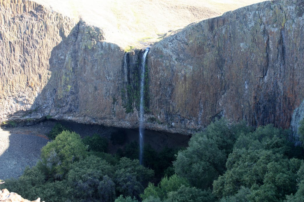
A hidden gem located in Oroville, California, Table Mountain offers over seventeen seasonal waterfalls, several caves, and a ghost town. Created millions of years ago by volcano overflow, Table Mountain gets its name from its prominent basaltic plateau. There are no trails so you have to explore this area old-school style by following streams to get to the waterfalls or by using a compass. After spending the day chasing waterfalls and hiking through ancient lava fields, you can grab a bite to eat and a beer at Sierra Nevada Brewery just a 30-minute drive away.
What Makes It Great
From late winter to early spring, nature lovers of all shapes and sizes flock to Table Mountain to catch a glimpse of the seasonal waterfalls and wildflowers. After driving from the small town of Oroville, up the narrow, winding Cherokee Road, you will arrive at an unmarked parking lot with a blue gate. The directions seem a bit like they’re from the movie Funny Farm, but the trailhead is actually easy to find.
The trailhead begins through a gate from the parking lot, but after that, there isn’t a trail at all. From the trailhead, you simply follow the running stream for a little over a mile to get to Flag Falls. Making your way through the rolling Kelly green hills, you will pass through fields speckled with lava rock and natural stone walls.
There are several falls throughout the mountain including the elusive Phantom Falls located in Coal Canyon a little over three miles from the main trailhead. A compass or GPS is recommended to find this waterfall.
Established by a small group of Cherokee Indians who were brought to the area, the small town of Cherokee is located on the mountain. You can check out the stone ruins of the “ghost town.”
Who is Going to Love It
From a leisurely stroll along the hills, to hiking the steep ravines, to exploring the caves behind the waterfalls, Table Mountain has something for everyone. The hike can be as long as you want it to be depending on what you want to see.
The falls are at their best after heavy rains, but keep in the mind the hills can be wet and slippery. Hiking shoes are recommended. Also, cattle are kept in the area to maintain the grass growth so there’s a bit of manure. Watch your step and don’t wear your favorite shoes. It’s also a good idea to keep a healthy distance between yourself and the cattle.
Directions, Parking, & Regulations
From Hwy 70 in Oroville, exit at Grand Ave (Exit 48). Go East (right) on Grand Ave for 1 mile. Turn left on Table Mountain Blvd for a tenth of a mile. Turn right on Cherokee Road 6.3 miles north to the reserve. Official access is through a parking lot on the west side of Cherokee Road. You will see a blue gate.
There is a fair amount of parking available on site.
Please note that there are no restroom facilities. There is also no drinking water available so be sure to bring your own.
Dogs are allowed on a leash.
Written by Shawn Lehman for RootsRated and legally licensed through the Matcha publisher network. Please direct all licensing questions to legal@getmatcha.com.
Featured image provided by Ray Bouknight


